
Wandering what’s on this May half term holidays? Check out our What’s On guide.
In the far north-eastern tip of Yorkshire’s Peak District, this circular Ramsden Reservoir walk offers lots of variety to keep all family members happy; there’s the beautiful views over the reservoir itself, woodland and streams to play in, open pastures, and even a pub-stop enroute.
This is quite a hilly route with lots of ups and downs as you pass between streams, but it never feels a slog due to all the natural play distractions and gorgeous views. Indeed, allow a good 3-4 hours for this walk, even though it’s only 4km.
Disclaimer: This post contains affiliate links. Should you click to purchase, it is at no additional cost to you, but I receive a small commission.
When planning your visit to the National Park, please arrive early or late in the day to avoid crowds if visiting over sunny weekends or school holidays. Please also take all litter home with you, don’t bring BBQs, and park your car in designated parking areas. Also, please use these walks as a guide; access and stiles may change.
PARKING INFORMATION: Please do not rely solely on the postcode for parking directions. In the National Park, a postcode can cover a large area. Postcodes are only provided as guidance. Please either use the Google Maps point or what3words, which are provided on every walk guide.
Ramsden Reservoir walk Map
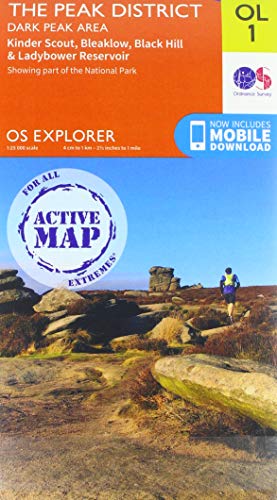
On all Peak District family walks it’s a good idea to have an Ordnance Survey paper map with you, even if you have your phone on you. For this walk you need the OS Explorer Map OL 01 (Dark Peak). It’s also a good opportunity to show young kids the map features and get them started with map reading.
| Preview | Product | Price | |
|---|---|---|---|
|
The Peak District: Dark Peak Area | Weatherproof | Peak… |
£13.55 |
Buy on Amazon |
This walk follows the below map in a clockwise direction.

Get a printable download of this walk
Want to print off this walk guide rather than rely on your mobile? Then click here to download the PDF to print out at home. Perhaps print out a copy for the kids to follow the step-by-step directions and/or photos? It’s a great way to get them engaged with the walk and gives them a sense of responsibility.
All printable downloads are £3 each. Click here for the full list of Peak District Kids printable downloads.
25% discount when you purchase 4 or more walk guides using code: PDKWALKS25
Please note that your download link expires 72 hours from order, so make sure you save your PDF somewhere where you’ll remember it. If you are unsure where your download folder is on your mobile device, we recommend you download the PDF on your laptop or desktop.

Need to know
DISTANCE OF WALK: 4.2km / 2.6 miles
TYPE OF WALK: circular reservoir and woodland walk with a pub stop enroute
PARKING: Brownhill Lane Car Park. Click here for Google Maps location. Postcode is HD9 2QE. Parking is free, although this is a small car park and spaces are limited (approximately 16 spaces, including 1 disabled space).
WALK HIGHLIGHTS: Ramsden Reservoir, playing in the stream, woodland, The Fleece Inn.
HOW LONG DOES IT TAKE: Whilst this walk can be done in 1 hour and 45 minutes, with young kids we recommend a good 3 hours; longer if you plan to stop at the pub.
ACCESSIBILTY: This walk is very hilly with lots of ups and downs. There are also a few stiles to climb over.
TOTAL ASCENT: 180 metres
FACILITIES: The only facilities on this walk are in the village of Holme where there is a pub (The Fleece) and public toilets opposite the pub.

The route
START: Brownhill Lane Car Park
Click here for Google Map point
Grid reference: SE 1150 0563
Post code: HD9 2QE
what3words: ///harmonica.churn.spots
Route follows a clockwise direction.
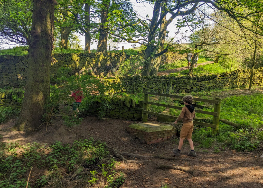
1. From the car park, take the footpath that leads through the woods up the hill, alongside a little stream. After 20 metres when you reach a picnic table on you right, cross over the stream and continue uphill along the footpath.
2. At the footpath junction, take a right. Then a right again at the next junction, to walk downhill through the pine trees.


3. At the bottom of the hill, take a left in front of the house. Follow the lane around to the right to cross over the reservoir.

4. Once you’re over the other side of the dam wall, continue straight ahead. 300 meters from the end of the dam is a stile on your right. Cross over this.
5. Keeping the drystone wall immediately on your right, follow the footpath downhill from the stile. Then take a left alongside the barbwire fence down to the a stream. This stream feeds into Ramsden Reservoir.

6. Cross over the footbridge (kids may want to find a way across using the rock in the stream). Then follow the arrowed footpath up the hill the other side.


7. At the top of the hill, immediately In front of the drystone wall, take a sharp left and follow this footpath towards the mobilephone mast. After 200 metres, the footpath bears around to the right following a derelict drystone wall, very gradually ascending.


8. When you reach the wooden stile at the top of the hill, climb over and continue straight ahead. Keep the derelict drystone wall on your immediate left and follow it as it bears rights towards Holme.

9. Cross over another wooden stile and head into the woods, following the stone steps steeply downhill. This leads to a footbridge over a stream. Continue the footpath uphill, on the other side of the footbridge.

10. The footpath leading up from the footbridge passes through a few wooden gates, and alongside a residential garden, before leading out onto a road. At the road, you will see The Fleece Inn just to the right. This is a lovely pub to stop in for refreshments or a bite to eat. If you are not stopping at the pub and need the toilet, there are public toilets across the road from the pub.


11. From The Fleece, continue along the road with the pub on your left. Just after the road bears round to the right, there is a footpath sign on your right. Take this footpath and follow it downhill.

12. Follow the arrows and walk down the stone steps to take a right towards a wooden stile. Climb over the stile and follow the footpath down to a footbridge over a waterfall. This is a great spot for a paddle (upstream from the bridge).


13. From the footbridge, follow the footpath to the left. This leads uphill for a short section and then levels out, before heading downhill at the footpath arrow signs.

14. Ramsden Reservoir soon comes back into view. Follow the arrows downhill to the reservoir, with railings either side of you. Then cross over the dam wall.

15. Walk up the steps on the other side of the dam and continue the along the path to the left. Then take a right along the road to the car park to complete this circular Ramsden Reservoir walk.

-
-
 My Walks Log Book£10.95
 -
-

Peak District Kids is a free online resource. If you have found this website useful for planning your family adventures, you can show your support by buying me a coffee. Thanks so much!

Also, feel free to share your walk photos in our Peak District Kids Facebook Group or on Instagram using by tagging @peakdistrictkids in your caption so we can share with our wider community.
Want more ideas for family walks?
Best Family walks in the Peak District
Pram-friendly Peak District walks
Toddler walks in the Peak District
Walks with a baby carrier
Or, use the search walks page to find your perfect family walk.
Also, come and join our friendly Peak District Kids Facebook Group for any questions or to share photos of your walks.
