Wondering what’s on over the summer holidays for families? Check out our What’s On guide.
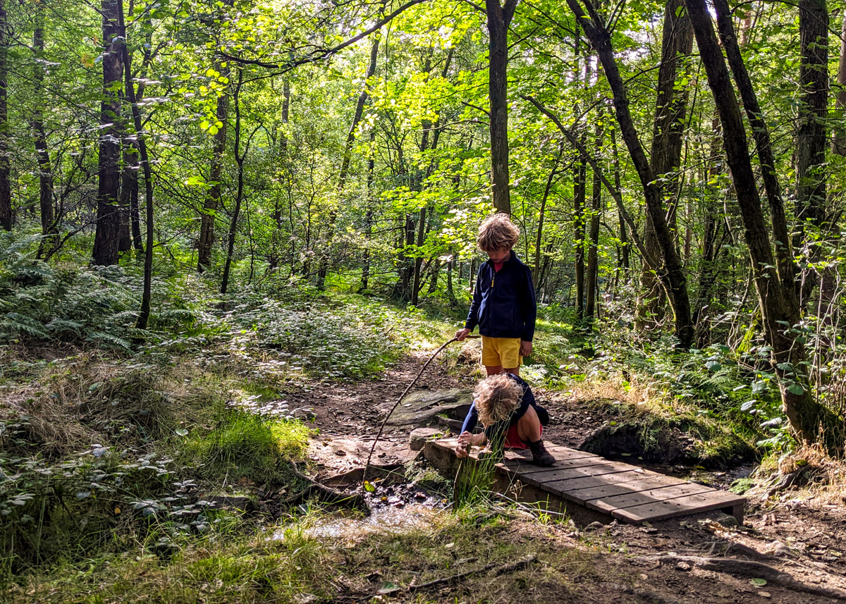
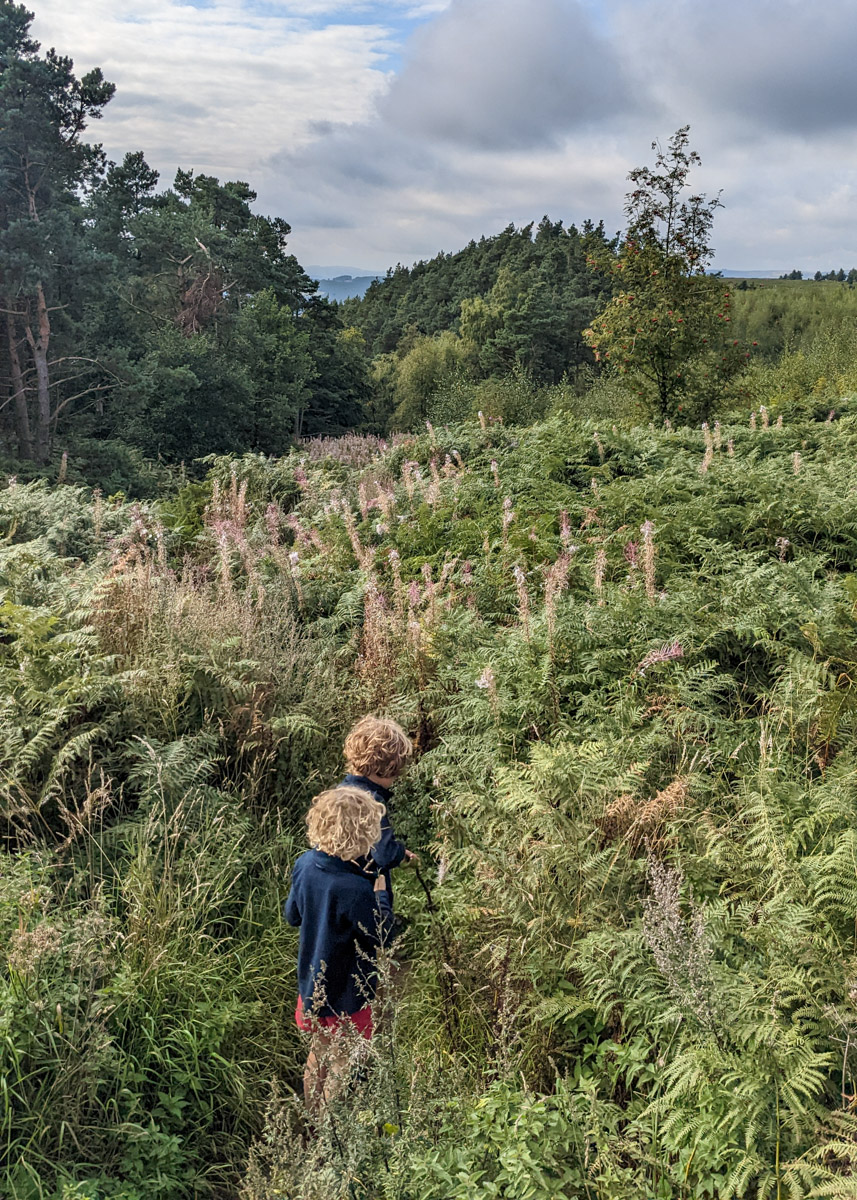
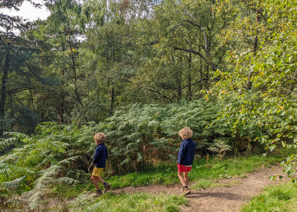
Commonly referred to as Beeley Woods (but not to be confused with Beeley Woods near Sheffield), Beeley and Hill Bank Plantation is a quiet and sheltered place for a Peak District family walk. Forming part of the Chatsworth Estate, footpaths criss-cross through the woodland and a brook tumbles down waterfalls. This walk is especially beautiful on a rainy day as the trees provide shelter, and the sound of the rain on the tree tops is beautiful.
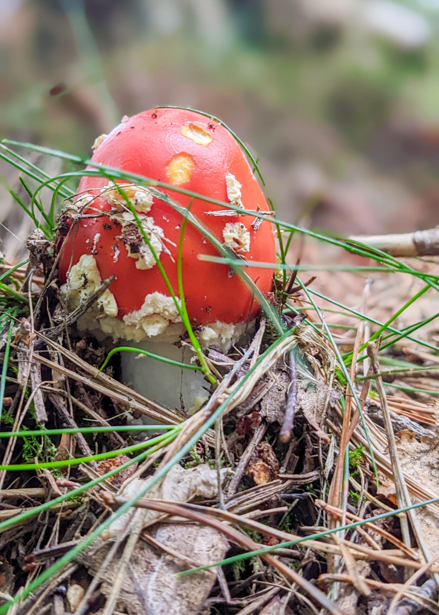
This was once one of our favourite woodland walks in the Peak District; however, extensive logging has significantly altered the latter section (steps 9-11). Large areas of trees have been removed, and heavy machinery has churned the footpaths into deep mud. It’s a real shame, but it’s worth remembering that this woodland is a commercial plantation rather than a protected ecosystem.
This is a short 2.7km walk around the Beeley and Hill Bank Plantation, but allow for a good few hours as the kids will love paddling in the stream and playing in the woods. Wellies during the winter months are a good idea, rather than hiking boots, so they can paddle.
It is not a flat walk. The first half of the walk is downhill, and the second half is uphill. Be careful underfoot, especially in wet weather, as the footpath is slippery in places.

Disclaimer: This post contains affiliate links. Should you click to purchase, it is at no additional cost to you, but I receive a small commission.
IMPORTANT READ: How to stay cool for your Peak District summer walks
When planning your visit to the National Park, please arrive early or late in the day to avoid crowds if visiting over sunny weekends or school holidays. Please also take all litter home with you, don’t bring BBQs, and park your car in designated parking areas. Also, please use these walks as a guide; access and stiles may change.
PARKING INFORMATION: Please do not rely solely on the postcode for parking directions. In the National Park, a postcode can cover a large area. Postcodes are only provided as guidance. Please either use the Google Maps point or what3words, which are provided on every walk guide.
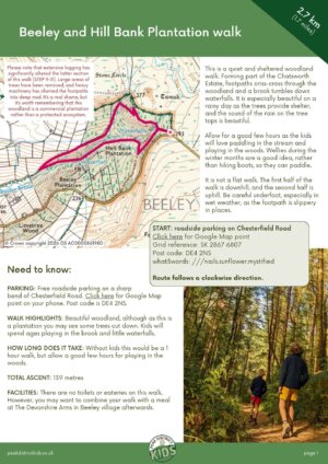
Beeley Woods walk map
On all Peak District family walks it’s a good idea to have an Ordnance Survey paper map with you, even if you have your phone on you. For this walk you need the OS Explorer Active Map OL 24 (White Peak). It’s also a good opportunity to show young kids the map features and get them started with map reading.
| Preview | Product | Price | |
|---|---|---|---|

|
The Peak District: White Peak Area Map | Weatherproof | Peak… |
£12.34 |
Buy on Amazon |
This Beeley walk follows the below OS map in a clockwise direction.

Get a printable download of this walk
Want to print off this walk guide rather than rely on your mobile? Then click here to download the PDF to print out at home. Perhaps print out a copy for the kids to follow the step-by-step directions and/or photos? It’s a great way to get them engaged with the walk and gives them a sense of responsibility.
All printable downloads are £3 each. Click here for the full list of Peak District Kids printable downloads.
25% discount when you purchase 4 or more walk guides using code: PDKWALKS25
Please note that your download link expires 72 hours from order, so make sure you save your PDF somewhere where you’ll remember it. If you are unsure where your download folder is on your mobile device, we recommend you download the PDF on your laptop or desktop.
Need to know
DISTANCE OF WALK: 2.7km / 1.7 miles
TYPE OF WALK: An short circular walk through woodland. Not flat. First half of the walk is downhill, and then the return is uphill.
PARKING: Free roadside parking on a sharp bend of Chesterfield Road. Click here for Google Map point on your phone. Post code is DE4 2NS.
WALK HIGHLIGHTS: Beautiful woodland, although as this is a plantation you may see some trees cut down. Kids will spend ages playing in the brook and little waterfalls.
HOW LONG DOES IT TAKE: Without kids this would be a 1 hour walk, but allow a good few hours for playing in the woods.
ACCESSIBILITY: Not pram or wheelchair friendly. There is a tricky stream crossing that using rocks to reach the other side (just about doable after heavy rains). In wet weather the footpath can get rather slippery. Also be wary of tree roots and branches across the footpaths.
TOTAL ASCENT: 139 metres
FACILITIES: There are no toilets or eateries on this walk. However, you may want to combine your walk with a meal at The Devonshire Arms in Beeley village afterwards.

The route
START: roadside parking on Chesterfield Road
Click here for Google Map point
Grid reference: SK 2867 6807
Post code: DE4 2NS
what3words: ///nails.sunflower.mystified
Route follows a clockwise direction.
1. Spot the stone stile on the left, just on the corner of the bend, leading off a gravel track. Climb over the stile and follow the footpath down into the woods. This initial footpath gets rather overgrown in the warmer months when you need to be careful with the nettles.

2. After 100 metres, take the path to the left. Follow this for 250 metres.
3. At the next footpath junction (it’s obvious, not the little turning just before on the right), take the path on the right. Follow this footpath downhill across a small, wooden footbridge, through the woodland. There are lots of places to stop and play along the stream and waterfalls.

4. You will reach a point where the footpath crosses the stream. There is no bridge, but there are a few rocks to aid you across. These can get submerged in heavy rain, but you should still be able to cross with wellies on.

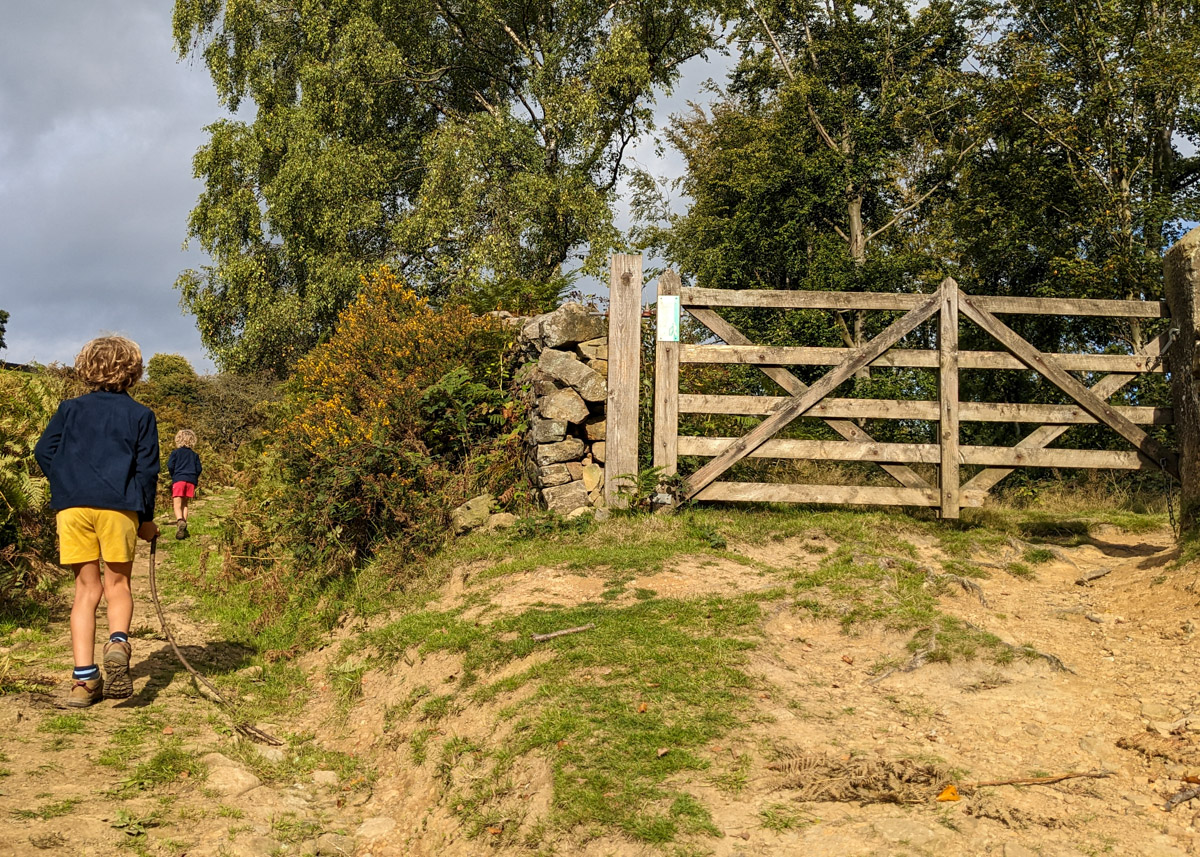
5. The woodland clears. Keep following this footpath to the wooden gate as shown in the photo below. If the gate is locked, there’s a steep stone stile to the left (quite a drop the other side). Then take the footpath on the immediate right, back up the hill again, keeping the stone wall on your right.

6. After 360 metres you will walk through a small wooden gate to the left of a metal gate (ignore the big wooden gate on the right).

7. Then a little further on (120 metres) you will reach a wooden gate.

8. After a short while, a footpath will meet you on the right; ignore, and continue straight ahead, slightly uphill. You will then come to a yellow arrow pointing left up some steps.

9. Before you walk up the steps, you may want to detour to the right for a little play by the stream. Then head up the steps, continuing to climb slightly, with a drystone wall on your left. You will walk over a wooden plank, and there will be another yellow arrow to lead you into what was once a deep dark wood, but unfortunately this area has recently been felled (photos of what it used to look like). It gets rather steep through here.


10. The footpath will eventually lead you out to a wooden footbridge that crosses the stream. Once you’re across, take the footpath on the right, and continue uphill.

11. After 140 metres there is a footpath T-junction. Take the footpath on the left. Then 40 metres along, take the footpath on the right.


12. Continue along this footpath, crossing over another stream (careful on those rocks!) After 40 metres, follow the footpath as it veers to the left (connecting with the footpath you first walked down at the start of this walk). Then follow the footpath back up to your car.


-

-
 My Walks Log Book£10.95
 -
-

Peak District Kids is a free online resource. If you have found this website useful for planning your family adventures, you can show your support by buying me a coffee. Thanks so much!

Also, feel free to share your walk photos in our Peak District Kids Facebook Group or on Instagram using by tagging @peakdistrictkids in your caption so we can share with our wider community.
Want more ideas for family walks?
Best Family walks in the Peak District
Pram-friendly Peak District walks
Toddler walks in the Peak District
Walks with a baby carrier
Or, use the search walks page to find your perfect family walk.
Also, come and join our friendly Peak District Kids Facebook Group for any questions or to share photos of your walks.
