
The festive season is in full swing! Check out our Christmas guide for family-friendly festive events in and around the Peak District National Park.
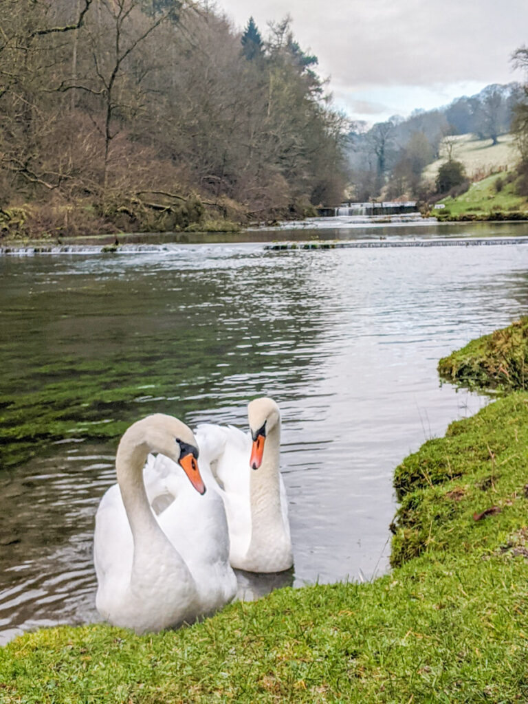
Lathkill Dale, where this Over Haddon walk leads to, is arguably one of the prettiest dales in the Peak District. Considering the heavily industrialised lead mining history of this dale in the nineteenth century, it’s remarkable to see how Mother Nature has healed the scars and restored it to such beauty.
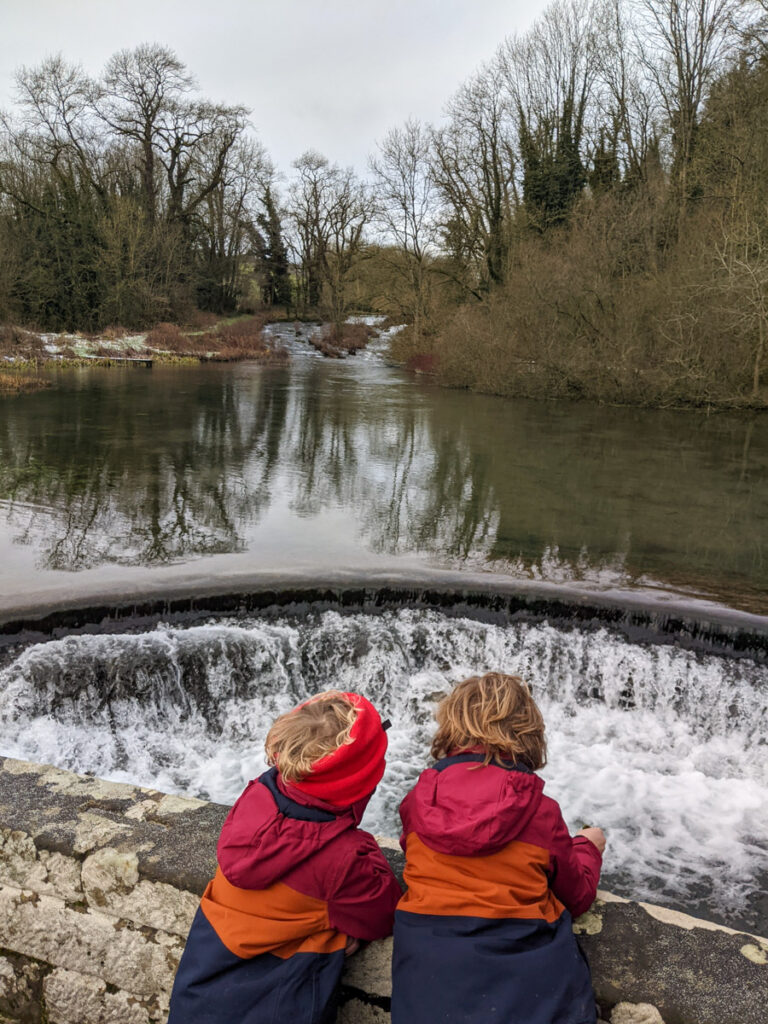
You may have followed our Lathkill Dale walk from Monyash. This Over Haddon walk also takes you to Lathkill Dale, but starts from the picturesque village of Over Haddon and leads you gently downhill across open meadows to explore the dale further downstream, crossing a packhorse bridge (Coalpit Bridge) and a medieval sheepwash bridge (Conksbury Bridge). This walk then follows the River Lathkill upstream along weirs that the Victorians built for trout fishing, and then leads back up into the village of Over Haddon.
Towards the start of the walk, you will pass The Lathkill Hotel, so this also makes for a lovely Peak District pub walk.
Please note that Lathkill Dale is a SSSI and there are Natural England signs along the river asking you not to go in to the water for a paddle.

Disclaimer: This post contains affiliate links. Should you click to purchase, it is at no additional cost to you, but I receive a small commission.
When planning your visit to the National Park, please arrive early or late in the day to avoid crowds if visiting over sunny weekends or school holidays. Please also take all litter home with you, don’t bring BBQs, and park your car in designated parking areas. Also, please use these walks as a guide; access and stiles may change.
PARKING INFORMATION: Please do not rely solely on the postcode for parking directions. In the National Park, a postcode can cover a large area. Postcodes are only provided as guidance. Please either use the Google Maps point or what3words, which are provided on every walk guide.
-
 My Walks Log Book£10.95
 -

Over Haddon walk map
On all Peak District family walks it’s a good idea to have an Ordnance Survey paper map with you, even if you have your phone on you. For this walk you need the OS Explorer Active Map OL 24 (White Peak). It’s also a good opportunity to show young kids the map features and get them started with map reading.
| Preview | Product | Price | |
|---|---|---|---|

|
The Peak District: White Peak Area Map | Weatherproof | Peak… |
£11.95 |
Buy on Amazon |
This Over Haddon walk follows the below OS Map in a clockwise direction.

Get a printable download of this walk
Want to print off this walk guide rather than rely on your mobile? Then click here to download the PDF to print out at home. Perhaps print out a copy for the kids to follow the step-by-step directions and/or photos? It’s a great way to get them engaged with the walk and gives them a sense of responsibility.
All printable downloads are £2.50 each. Click here for the full list of Peak District Kids printable downloads.
Please note that your download link expires 72 hours from order, so make sure you save your PDF somewhere where you’ll remember it. If you are unsure where your download folder is on your mobile device, we recommend you download the PDF on your laptop or desktop.

Need to know
DISTANCE OF WALK: 5km / 3.1 miles
TYPE OF WALK: circular, some steep sections.
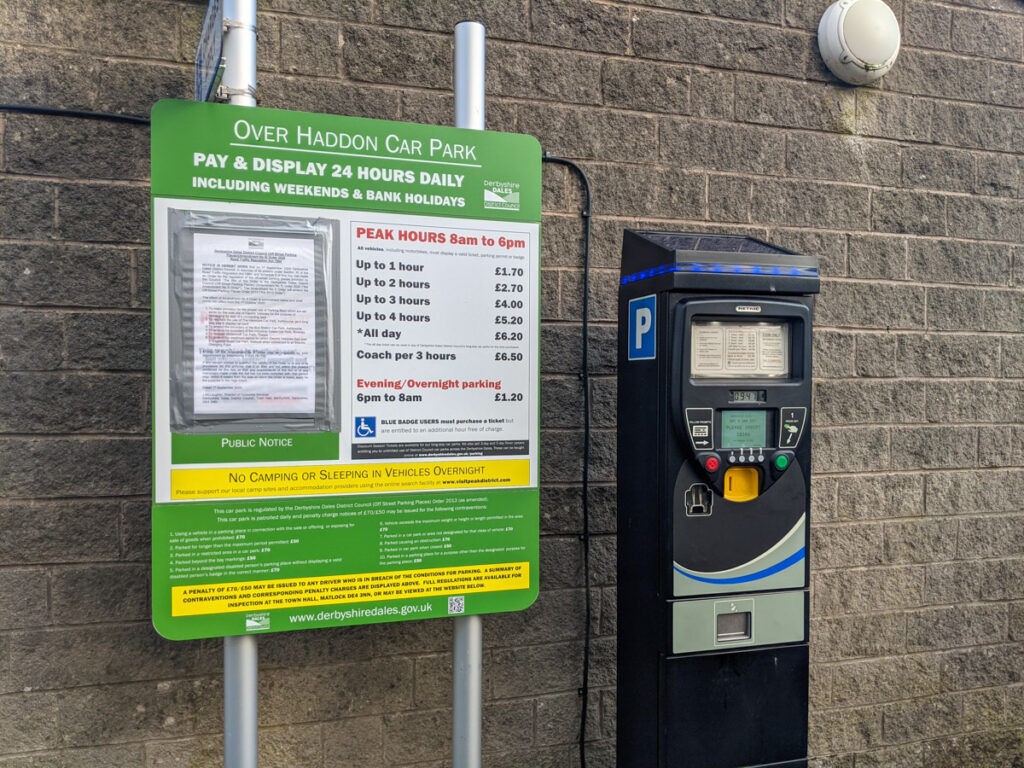
PARKING: There is a good sized pay and display car park in Over Haddon run by Derbyshire Dales District Council. Click here for Google Maps point, postcode DE45 1HZ. All day parking is £2.20. The parking machine ONLY takes coins, but there is also a Pay by Phone option.
WALK HIGHLIGHTS: Stunning views, walking alongside the weirs of Lathkill Dale, Conksbury Bridge and Coalpit Bridge, the village of Over Haddon.
HOW LONG DOES IT TAKE: Without kids, this is a 2 hour walk. With young kids allow a good 3 hours.
TOTAL ASCENT: 130 metres
PUBLIC TOILETS: There are public toilets at the car park in Over Haddon. The Lathkill Hotel is a good spot for a drink or bite to eat; try and grab a table outside for one of the best pub views in the Peak District.

The route
START: Over Haddon car park
Click here for Google Map point
Grid reference: SK 2034 6646
Post code: DE45 1HZ
what3words: ///outright.remainder.funky
Route follows a clockwise direction.
1. From the main car entrance to Over Haddon car park, take a right and then a left along Main Street. Follow this right to the other end of the village, following signs to The Lathkill Hotel. Once you reach The Lathkill Hotel (there’s also parking here for patrons) you may want to pop in for a drink before you start your walk (or return here at the end of the walk).


2. Walk to the far side of the pub, and at the corner of the bend you will notice a stone stile. Take the higher footpath that goes straight ahead, not the footpath that veers right.

3. Continue walking to the next stone stile, and follow the yellow arrow straight ahead. This leads you gradually downhill through another stone stile, then a wooden gate, to then lead you out onto a lane.


4. Cross over the lane and follow the short footpath immediately opposite, which veers left to a steep stone stile. Climb over, and then follow the footpath to the right with the drystone wall on your right. Continue along here for 750 metres. Note, that there’s a trig to bag here – Noton Barn trig point. After you climb the stile, walk slightly to the left to the next drystone wall and you’ll see it poking up behind. This is on private property, and you need to ask the landowner’s permission to access it. But you can (just about) touch it from your side of the wall (be careful of the double-barbed wire); we just use a stick to bag this trig.


5. Just before you reach the farm buildings, there is a wooden gate on your right. Walk through the gate and follow the blue arrow across the fields. It gets very muddy here.

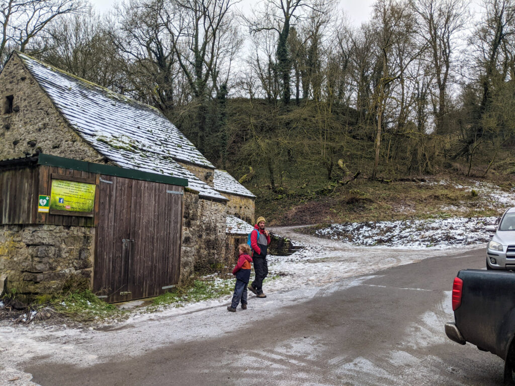
6. After 200 metres, you will see this gate photographed below (top left). Walk through the gate and follow the footpath that zig-zags through the woodland, down to Coalpit Bridge.


7. Walk over the bridge and straight ahead for 70 metres. Then take the footpath on the right. This follows the River Lathkill upstream for 400 metres, and then leads out onto a road.


8. Take a right and follow the road down to Conksbury Bridge.

9. On the other side of the bridge is a footpath on the left that continues along the River Lathkill upstream. Follow this footpath for 1100 metres. The river will be on your left. Please stick to the paths and note that paddling is not permitted.


10. You will then reach a big white house next to the river. Just behind this is a lane on the right that leads back up to the village. It’s 400 metres uphill and back to your car.


After your walk
If you didn’t get a chance to pop in at the start of this Over Haddon walk, now is the time to head to The Lathkill Hotel. Those views across the dale are pretty special with a pint (or hot chocolate with cream and marshmallows) and the food is good too.

Peak District Kids is a free online resource. If you have found this website useful for planning your family adventures, you can show your support by buying me a coffee. Thanks so much!

Also, feel free to share your walk photos in our Peak District Kids Facebook Group or on Instagram using by tagging @peakdistrictkids in your caption so we can share with our wider community.
-
My Walks Log Book£10.95
-
Want more ideas for family walks?
Best Family Walks in the Peak District
Pram Friendly Peak District walks
Toddler walks in the Peak District
Or, use the search walks page to find your perfect family walk.
Also, come and join our friendly Peak District Kids Facebook Group for any questions or to share photos of your walks.